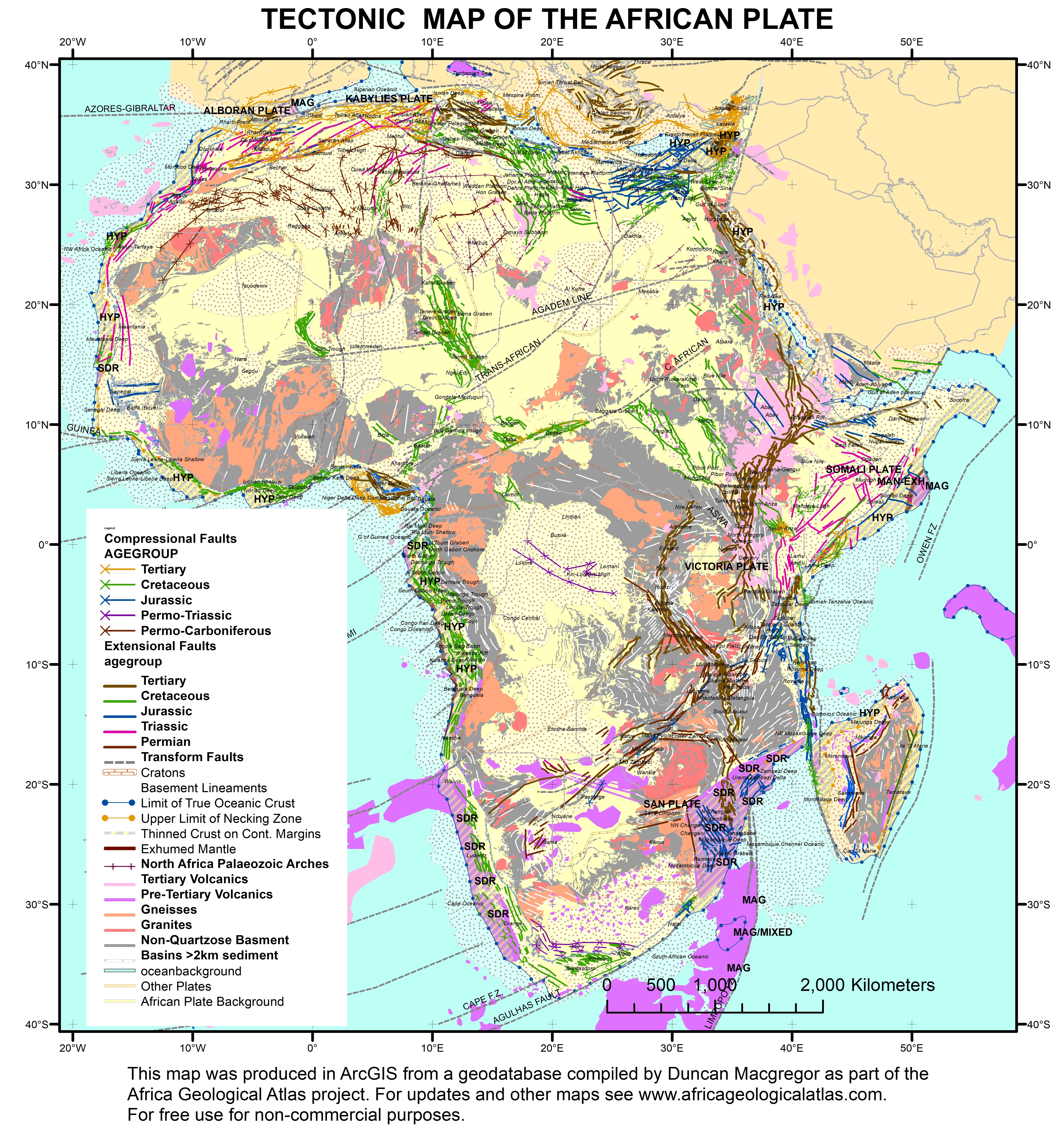
Tectonic Elements Map of the African Plate
Lineaments have been digitised from multiple publications, both academic (onshore) and industry sourced (mainly offshore). The map shows existing lineaments by type and interpreted age as well as the latest interpretation of continental margin type, derived largely from unpublished petroleum industry work. Between the interpreted necking zones and limits of true oceanic crust (or of exhumed mantle) lies a zone of thinned continental crust, either with high angle rifts (HYP=hyperextended) or with thick seaward dipping reflectors (SDRs). The interpretation of transform lineaments crossing the African plate is schematic : further work on this is required.